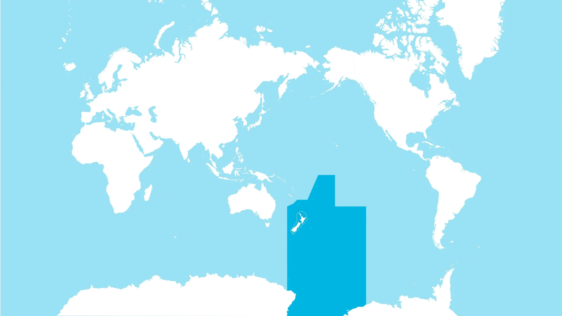
We manage the safe movement of aircraft across 30 million square kilometres of airspace – one of the largest airspace regions in the world. From departure to arrival, our air traffic controllers ensure the safe separation of aircraft in our airspace and the efficient operation or aircraft around the airports where we operate.
Where we operate from
- 17 air traffic control towers at airports across New Zealand
- Two flight Information services towers at Milford aerodrome and Kapiti Coast Airport
- Two air traffic control centres managing high altitude and busy air traffic routes.
Our flight information regions
The NZ domestic flight information region (FIR) covers the entire country and surrounding coastline, with both 'controlled' and 'uncontrolled' airspace.
The Auckland Oceanic FIR covers close to 29 million square kilometres of the South Pacific Ocean, the Southern Ocean and the Tasman Sea, extending from 5 degrees south of the equator to Antarctica. We are responsible for aircraft flying between 24,500 feet and 60000 feet in this sector.
Airspace overview
The airspace above New Zealand is divided to keep all aircraft, passengers, and airspace users safe.
Controlled airspace
Controlled airspace is actively managed by our air traffic controllers to ensure safe and efficient flight operations.
Uncontrolled airspace
In uncontrolled airspace, aircraft are not actively separated by air traffic controllers, but they may receive flight information services to support their safe operations.
While aircraft in uncontrolled airspace may not always be visible to air traffic control, pilots must still follow Civil Aviation Authority regulations.
Numerous airports across New Zealand operate without Airways services. Light aircraft and helicopters frequently operate in uncontrolled airspace, especially at low altitudes and in scenic areas like Fiordland and the Bay of Islands.
Airspace classifications
Both controlled and uncontrolled airspace in New Zealand are further divided into different classes, as determined by the Civil Aviation Authority. Each class has specific rules and regulations that pilots must follow to ensure the safety and efficiency of all airspace users. The location and boundaries of these classes vary depending on a number of factors including the location, altitude, topography, traffic density and types of operations happening in the area.
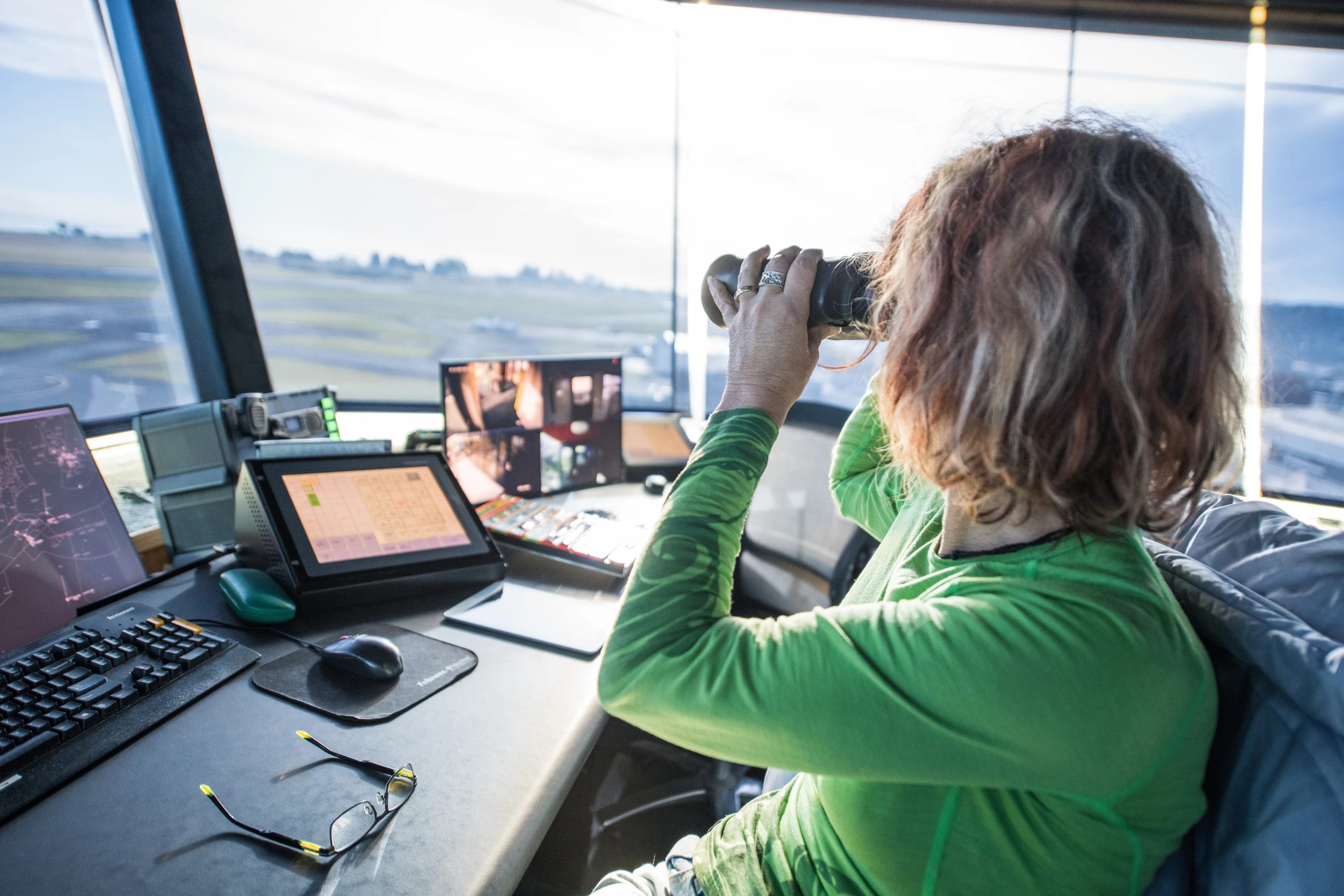
Who’s in control
Ensuring the safe and efficient movement of aircraft in New Zealand's skies is the responsibility of highly skilled professionals.
Each of our Air Traffic Controllers (ATC) and Flight Service Officers (FSO) have specific areas of responsibility, overseeing different stages of a flight. Their combined efforts ensure every aircraft in New Zealand's airspace operates safely and efficiently.
ATCs are tasked with maintaining the safe separation of aircraft and providing pilots with critical flight information throughout their journey. From departure to arrival, they issue instructions and advice using advanced communication tools and surveillance systems. ATCs operate from 17 airport control towers across the country, our surveillance centre in Christchurch, and the Oceanic Control centre in Auckland.
FSOs support the safe and efficient operation of flights by offering essential advice and information. They work from aerodromes, including Milford and Kapiti Coast, as well as our primary surveillance centre in Christchurch.
Tracking aircraft through our skies
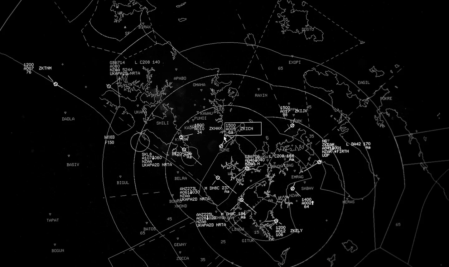
Automatic Dependent Surveillance Broadcast (ADS-B) is the main aircraft surveillance technology used by Airways to monitor aircraft travelling in domestic controlled airspace. ADS-B uses satellite GPS systems, aircraft transmitters and a network of ground stations and receivers to track aircraft with a precise level of accuracy.
Airways maintains a network of Monopulse Secondary Surveillance Radar (MSSR) systems as a back-up to ADS-B.